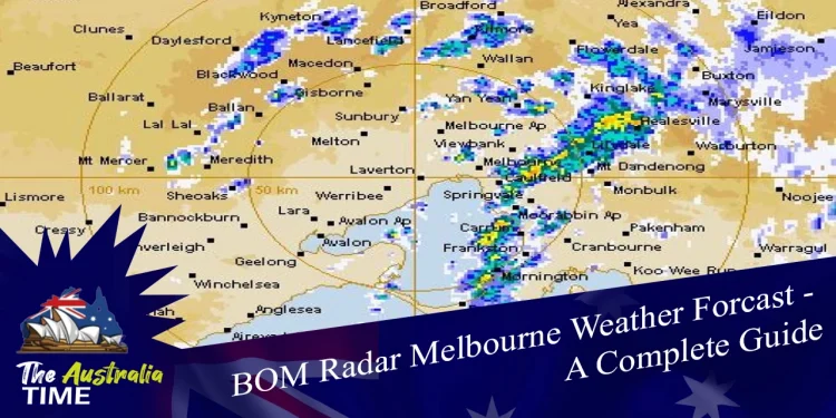
The Australian Bureau of Meteorology is an executive agency of the Australian government. BOM Melbourne task with forecasting the weather for the country and its regions. It was created in 1906 under the Meteorology Act.
Merged the previously existing governmental meteorological agencies. On 1 January 1908, the states formally surrendered their weather recording responsibility to the BOM. The BOM Radar Melbourne is Australia’s primary source for weather predictions, alerts, and observations.
The bureau transmits weather graphics through radio fax. And is in charge of Australia’s flood warning system. Melbourne Docklands is where the bureau’s head office is located.
And also contain:
- Research Centre
- Bureau’s National Operations Center
- National Climate Center
- Victorian Regional Forecasting Centre
- Hydrology and Satellite departments
Each state and territory has a district headquarters in its capital. In addition to regional forecasts, each regional office has flood warning features.
Geographical Location Of Bom Melbourne Radar
On the west side of Melbourne, the radar locates.
19 km west-southwest of the CBD.
6 km from the western coasts of Port Phillip Bay.
And on a modest elevation of around 20 meters above mean sea level.
The radar locates on a 24-meter high tower.
From east to west, north to south, the Great Dividing Range covers the region.
Starting from the east, the most significant obstacles are;
- Mt Dandenong (644m), 53km to the east
- Yarra ranges (1219m), 83km to the east
- Mt Macedon (1013m), 56km to the north
- Pentland Hills (763m), 56km to the north
- Brisbane ranges 421m, 45km to the west
- You Yangs 363m, 30km to the southwest
Aspects Of Meteorology
The location of the Bom Radar Melbourne gives excellent coverage of the Greater Melbourne Metropolitan Area. From the east, north, and south, the high land tends to mask shallow rain falling further away.
Summer thunderstorms develop on the neighboring hills and mountains. Winter storms with rain and thunderstorms may arrive from the northwest, west, or south.
The position on the floor of a large basin is suitable for Doppler wind speed observations.
Non-Meteorological Considerations
In most situations, radar data processing removes continuous echoes created by barriers. Such as hills, buildings, and other solid objects rather than rain. Some lasting echoes will be visible in the presentation.
The echoes are most abundant around the Yarra Ranges to the ENE and Mount Macedon to the north. Where they appear as solitary, stationary patches along ridges and summits.
On chilly, bright winter evenings or early winter mornings, they tend to become more visible. Sea clutter may be visible across the bay during severe winds. Since the radar has an uninterrupted view of Port Phillip Bay out to around 25km.
Because they don’t travel with the wind and cease at the bay’s shoreline. These echoes may separate from rain. Multipath reflections of Melbourne City skyscrapers;
and incoming rain bands might cause Doppler observations to distort.
In the area to the northeast of the radar; these show up as radials with inaccurate Doppler velocities. Over Port Phillip Bay, Doppler studies can indicate the existence of flocks of birds. They look like thin lines and have a higher velocity than the surrounding region.
How Does A Mob Melbourne Radar Work?
Doppler weather radars are devices that send electromagnetic energy pulses into the atmosphere to detect;
- Precipitation
- Estimate its velocity and intensity
- Determine whether it is rain, snow, or hail
When an electromagnetic pulse hits anything like a raindrop or a snowflake, the wave returns to the radar.
Provide data for meteorologists to study. With this information, meteorologists pinpoint particular places where severe weather conditions emerge.
Radar may be a useful tool in a meteorologist’s device to help safeguard life and livelihood.
What Are The Advantages Of MOB Weather In Melbourne?
Having the correct MOB Melbourne weather Bom data can result in several advantages:
Forecast Approaching Storms
- Your team can identify dangerous weather like tornadoes, hail, or flooding.
- Locate and compute precipitation speed to enable exact arrival timings.
- Using a high-quality weather radar system.
Data That Is Both Reliable And Of High Quality
- By delivering dependable forecasts and precise findings.
- High-quality data can assist meteorologists, broadcasters, and other sectors.
- Putting insights into action in a timely and effective manner.
Credibility
- Forecasting errors can readily dissatisfy viewers.
- More accurate data may help visitors gain confidence.
- Credibility, which will keep them coming back.
Why Is It So Essential To Have Correct Weather Radar Data?
A weather radar is essential for giving accurate; and quick hourly nowcast Melbourne weather bom reports in real-time. Meteorologists may think this technology is the best way to predict; when precipitation will happen.
Perhaps more significant is the capacity to predict the intensity and severity of coming weather. Whether there is a high or low risk of injury or property damage.
Radar data may also be fed into forecast models. Allowing for better data initialization. As a result, better short-term forecasts, generate within 36 hours.
Radar is the foundation of news stations’ and utility businesses’ forecasting strategies. A weather radar is used by meteorologists to keep viewers informed so that they can prepare for severe weather. And determine whether or not to evacuate a region.
Radar data is used by utility providers to determine when and how to prepare workers for possible disruptions.
For Further Details about Australian Weather, News updates, Stories and cities just logged in: The Australia Time


